Delaware County, Indiana
Discover Delaware County - an east central Indiana community of opportunity


Contact Us

Chief Information Officer
- Phone: (765) 213-1269
- Staff Directory
- Office Hours:
8:30am-4:00pm Monday- Friday
Appointments are Required.
Call 765-213-1269
In this Department
Office of Information and GIS Services
SPECIAL NOTICES:
The Office of Information and GIS Services is located in the Emergency Operations Center which is a secured facility and is open by appointment only.
For specific questions related to property/parcel boundaries contact the Auditor's Plat Room at 765-747-7717.
The Office of Information and GIS Services Department is the single point of contact for Delaware County's web-based applications and creates, maintains, and provides access to county GIS databases. In addition, the OOI-GIS Dept is integrated into the Delaware County Homeland Security and Emergency Management Agency, providing technical support, logistics and planning services, and incident response along with HSEMA staff to the public safety agencies in Delaware County.

ArcGIS Online Map Gallery
Open Data
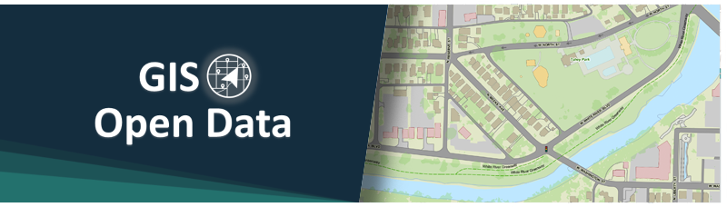
We have been working to make as much of the data we maintain available through web-based applications for ease of access and use. In addition, much of our data is available for download as well through our Open Data site located at: maps-delcogis.opendata.arcgis.com
What is GIS?
The Delaware County Office of Information (OOI) manages the County's Geographic Information System (GIS). A GIS is a computer-based mapping system that relates various types of data and information to real-world locations.
The Delaware County OOI has three primary goals:
-
To efficiently create and maintain a state-of-the-art GIS that accurately and comprehensively represents all relevant and useful geographic data and information about the County
-
To deliver this data to the general public, private sector clients, and associated governmental agencies
-
To provide expert GIS consulting and application development
The basis of Delaware County's GIS is its library of GIS data layers. These layers provide a comprehensive representation of the County's property fabric; basic infrastructure; environment; recreational facilities; governmental structure and facilities; emergency services infrastructure and facilities; and transportation network.
These GIS data layers are developed and maintained by the OOI and other County Departments utilizing ESRI's suite of ArcGIS software.
What do we do?
As an enterprise GIS, one key objective of the OOI is to seamlessly integrate GIS into the daily workflows of County and City Departments and partner organizations. In other counties and organizations, GIS integration has provided time and cost savings, improved analysis capabilities, and enhanced decision-making capabilities. Therefore, to facilitate GIS integration, the OOI provides consulting services to its internal County agencies as well as its partner organizations. The OOI examines business practices for departments and develops recommended areas for applying GIS to daily tasks. Under certain circumstances, the OOI also will develop custom applications to meet the needs of County departments and partner organizations.
We provide Geographic Information support to all government agencies, citizens, community organizations, and many others.
Information and geographic support include, but is not limited to:
- Management of the county's web-based applications, website, and social media accounts.
- printed and digital map creation
- custom web-based map applications
- web-based data collection applications
- geographic analysis
- address geocoding
- suitability studies
- land analysis
- hazard analysis
- field data collection
- spatial data collection
- environmental analysis
- inventory management
-
geographic systems education and presentations
-
integration of GIS into government offices
- cartographic and graphic design
Why GIS?
Our ultimate goal is to make County GIS information accessible from anywhere, to whoever needs it.
- Recent
News - Events
- Useful
Links - Services
Upcoming Events
- Good Friday - County Offices Closed
| All Day - Primary Election - County Offices Closed
| All Day - Memorial Day - County Offices Closed
| All Day - Independence Day Holiday - County Offices Closed
| All Day - Labor Day - County Offices Closed
| All Day
Useful Links
- Sign Up to Receive Emergency Alerts from Delaware County Emergency Management
- Delaware County Indiana Enhances River Safety with New Mile Marker System on the White River
- Video PSA - Severe Weather Awareness with Delaware County Emergency Management
- Delaware County Surveyor Embraces GIS Technology to Improve Drainage Management
- Who to Call in Delaware County
- Delaware County Attractions - A StoryMap
- Enhanced Public Safety Through Comprehensive GIS Mapping in Delaware County, Indiana
- Closure of County Road 650 East for Bridge Replacement - Starting Feb 19th, 120 day closure.
